The Democratic Republic of Congo is known for its fertile forests which cover over 68% of the country and heavy rainfall that often exceed 150mm per month. These precipitations take their toll on a vulnerable road network, leading to acute erosion events throughout the year.
The deterioration of the road systems complicates the transport of goods and people and the implementation of development initiatives.
Despite the important investments in the rehabilitation of the transportation network in the last twenty years, the secondary road network condition still requires improvement. The rural and agricultural feeder roads are mostly unpaved and highly vulnerable to climatic conditions, while a key factor for the development of the local agriculture and economy.
The World Bank group activities in the country are severely impacted by road impassibility. As a result, it was interested in trying to assess the vulnerability of the network in order to better plan its activities and set up appropriate contingency plans.
To this end, the World Bank group turned to the EO4SD-FCS consortium to investigate if satellite data could be of any use in the elaboration of a prioritization strategy in order to target rehabilitation and maintenance efforts. The team was interested in a tool to monitor the degradation of road condition over time.
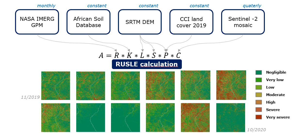
Figure 1: Revised Universal Soil Loss Equation model
SIRS, a subsidiary of the CLS group led the technical investigation and proposed a solution based on the combination of topography, Sentinel-2, environmental and meteorological datasets to compute a global erosion index, the Revised Universal Soil Loss Equation index1. Coupled to a road network map, this enabled the team to identify the road sections that are the most vulnerable.
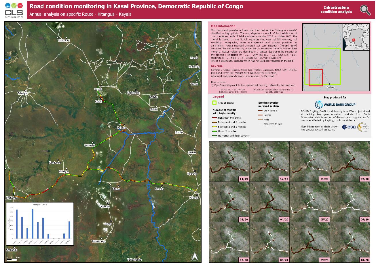
Figure 2: Road section vulnerability analysis
The WB team was very pleased with the results and intends to present them to the DRC office in charge of maintaining the road network in rural areas which will hopefully lead to a ground mission to verify the results.
1 Renard, Kenneth G. Predicting soil erosion by water: A guide to conservation planning with the Revised Universal Soil Loss Equation (RUSLE). USDA Agriculture Handbook 703. Washington D.C.: U.S. Government Printing Office, 1997.